In this research article, we have outlined the Inca Trail History of the section of Inca Trail to Machu Picchu, from the first archaeological findings to the information contained in documents found in various archives throughout Peru. It is important to mention that the true history of the Inca Trail to Machu Picchu remains a mystery, as several generations of Quechua peoples were decimated after the arrival of the Spanish in Peru and retreated to the most remote jungles of the South American continent. The Qhapaq Ñan, or Inca Trail, is a unique architectural space that links the great historical, cultural, human, and geographical diversity of Peru both temporally and spatially. This road, which has facilitated the movement of people from the time of the Incas to the present day, has become the quintessential means of communication and ritual exchange for the peoples of the Andean world.
The Inca Trail History is intertwined with the diverse Andean societies that participated in its construction. Even today, several of these Andean ethnic groups still practice their oral traditions and dances related to the construction of houses, roads, bridges, and public buildings. The Inca Trail served as a main artery of the Tawantinsuyu (Inca Empire), connecting the varied Andean territory. To achieve this, the trails were adapted to the diverse environments thanks to the well-designed architectural components applied to the various sections of the Andean Road System.
From the earliest human presence in the Andes, the process of establishing routes and territorial organization began, guided by the natural characteristics of the land, landscapes, and resources. Furthermore, the need to satisfy basic human needs, as well as spiritual ones, also played a role. Within this context, areas with abundant food, game, and fish, whether seasonal or permanent, facilitated the construction of trails providing access to these resources. Obtaining materials for toolmaking, and accessing mystical places like mountains, snow-capped peaks, and volcanoes, were crucial then and remain so today. Thus began the Inca Trail History, with the formation of settlements and later the emergence of integrated and centralized political systems. Many of these routes were formalized. Others developed due to different needs; several roads are regional, interregional, and even serve large territories.
The Inca Road to Machu Picchu emerged as the culmination of a process of expansion and political consolidation of the Tahuantinsuyo (Inca Empire) between the 15th and 16th centuries AD. Its systematic construction was intimately linked to the need to control a vast and diverse territory that encompassed nearly 2 million km², from southern Colombia to central Chile. The Incas did not start from scratch; they took advantage of and unified a pre-existing network of trails and roads built by earlier civilizations (such as the Wari, Tiwanaku, Moche, and others), improving, expanding, and connecting them into a system.
The Inca Road functioned as the circulatory system of the Empire, vital for the redistribution of goods, the mobilization of the workforce, and the transfer of knowledge. Its emergence was not merely an administrative act, but also a process of ideological imposition: the physical road materialized the sacred connection with the ancestors and the huacas (sacred places), and its use was regulated by a strict social order. The network, which exceeded 30,000 km at its peak, integrated the coast, the highlands, and the jungle, facilitating the flow of products such as corn, alpaca wool, dried fish, and coca.
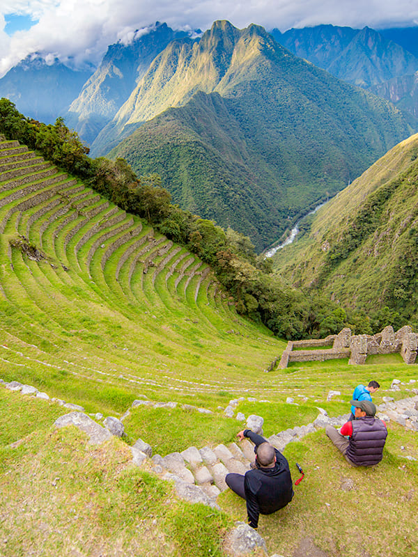
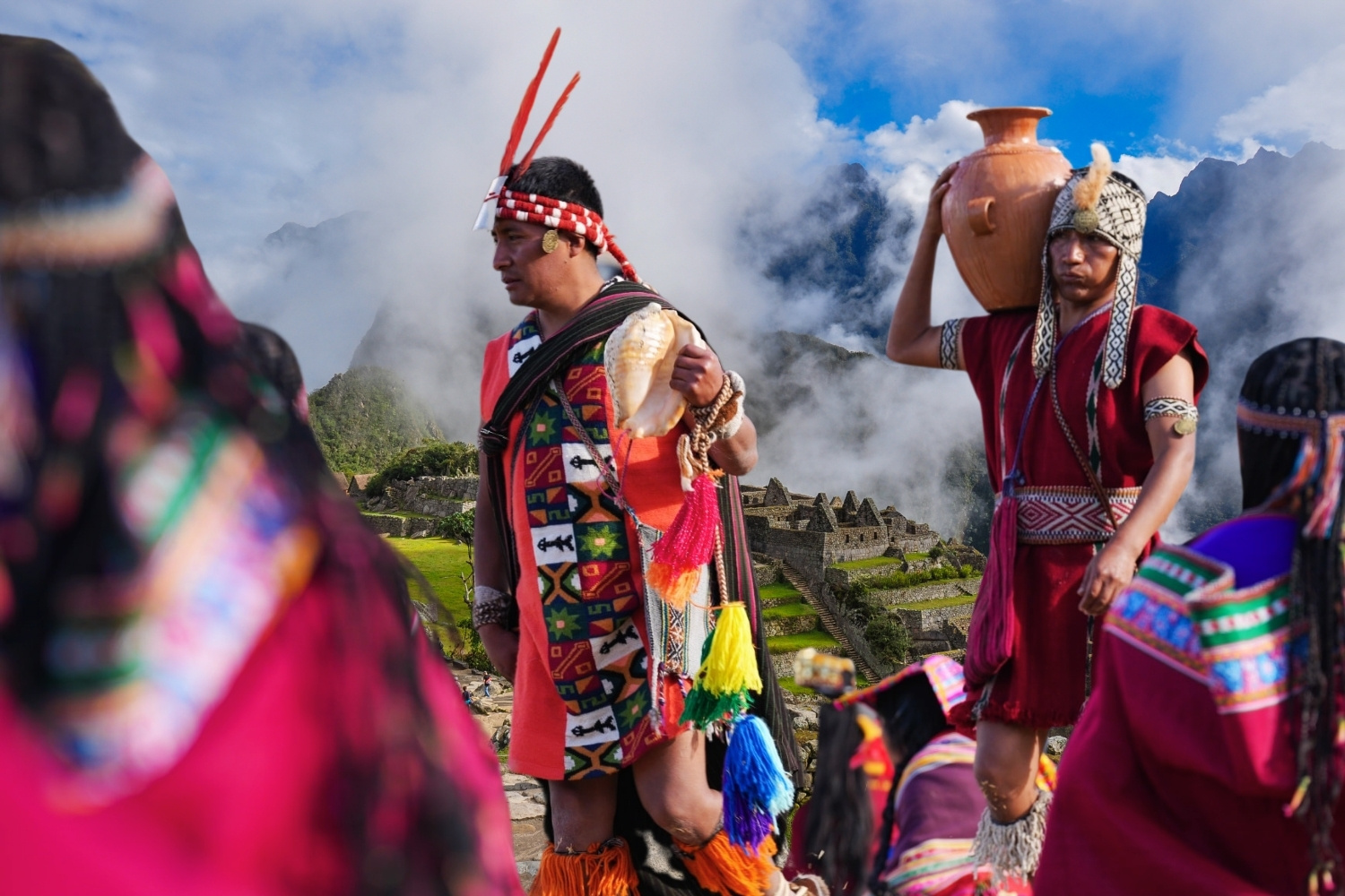
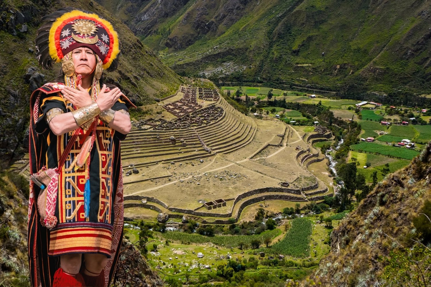
The Great Inca Road leading to Machu Picchu arose as a strategic and ceremonial branch of the vast Qhapaq Ñan road system. Its construction was ordered by the Sapa Inca Pachacuti in the 15th century, following the expansion of the empire into the Cusco region and the founding of the llacta (city) of Machu Picchu. This road did not have a primary commercial or military purpose, but rather functioned as a pilgrimage route and exclusive access for the imperial elite and the royal retinue to the sacred complex. Its layout was intentionally designed to create a ritual experience of approaching the citadel, integrating a sequence of sanctuaries, checkpoints (such as Intipunku, the Gate of the Sun) and residential complexes (such as Wiñay Wayna) that physically and spiritually prepared the traveler for the arrival at the majestic environment of Machu Picchu.
The construction of the Inca Trail leading specifically to Machu Picchu was initiated by order of the Sapa Inca Pachacuti (ruler from approximately 1438 to 1471 CE), the founder and transformer of Tahuantinsuyo into a vast empire. It was under his military leadership and visionary administrative reorganization that the territory of Cusco expanded enormously, and Machu Picchu was planned and built as a llacta (city-state) of great ceremonial and administrative importance, and likely as a royal retreat. Therefore, the access infrastructure to this sacred complex, including the specific branch of the Qhapaq Ñan that we know today as the “Inca Trail,” was a state project directly associated with the will of this ruler, an integral part of the overall design of the citadel and its function within the empire.
Pachacuti’s initiative was not an isolated act, but rather the culmination of centuries of accumulated knowledge. The physical construction of the road was carried out by Inca specialists (engineers and architects) and a massive workforce organized through the mit’a system, a rotating labor tribute that conquered populations owed to the state. These workers, supervised by imperial administrators (orejones or curacas), applied advanced engineering techniques to adapt the route to the steep topography of the cloud forest. It is crucial to understand that the road, although newly constructed, may have integrated and improved upon pre-existing trails of local cultures, but its conception as a processional route and controlled access to Machu Picchu was a work of centralized Inca planning, reflecting the Sapa Inca’s absolute power to mobilize resources and labor.
In a deeper sense, the beginning of construction can also be attributed to the Inca state and religious ideology. The road was designed not only as a physical route, but also as a spiritual and symbolic experience. Its layout intentionally connected shrines (huacas), sacred water sources, and secondary residential complexes, creating a ritual of pilgrimage and ascent to the citadel. In this context, the “beginning” corresponds to a divine mandate, where the Sapa Inca, considered the son of Inti (the Sun god), ordered the transformation of the landscape to materialize the cosmological order and his own sacred power.
From a technical perspective, its construction was a masterpiece of engineering, adapting to the difficult terrain of the cloud forest. The Inca builders took advantage of the natural rock formations and designed a paved road with staircases, tunnels, drainage systems, and retaining walls to overcome the steep slopes and prevent erosion from torrential rains. The route was planned with precise logistics, including tambos (lodging stations) and agricultural terraces to sustain the pilgrims and the garrison. Thus, this path emerged not only as a physical connection, but as an integral element of the sacred and landscape design of Machu Picchu, symbolically isolating it from the general population and enhancing its character as a royal retreat and first-rate ceremonial center within the sacred Inca geography.
This road is short and branches out rapidly. In some sections, it must be paved, and on stretches like the one to Machu Picchu, it is also quite elegant. The mountain roads are difficult and costly to maintain and construct due to the rainy conditions and steep slopes. Their purpose was to obtain wood, coca, wax, honey, feathers, and drugs for Inca religious practices. Like the roads on the northern coast, they were lined with fortifications built on the summits of the intervening hills. The main road in Antisuyu was 3 to 5 meters wide at the exit from Cusco, south of Sacsayhuaman.
The Inca roads were pedestrian-only, adapted for camelid caravans and the movement of thousands of soldiers in the imperial armies. They were designed for the movement of people, animals, and cargo, and indeed, both the applied engineering and the maintenance and service work give the structure considerable value. Thanks to the flow of communication facilitated by the Inca Road, the Incas were able to effectively organize the entire Tawantinsuyu. Every 10 to 20 km, Chasquiwasi (messenger houses) and Tambos (lodging stations) were located. These sites allowed travelers to rest and resupply before reaching the various communities and administrative centers they were heading to.
From the provincial centers, the Inca governors maintained control of their respective territories. To this end, each center had a set of buildings specifically designed to fulfill certain functions, such as those for lodging officials (Kallanka), housing and workshops for the production of goods (Cancha), resource storage (Colca), housing for chosen young women (Acllawasi), and for holding public ceremonies and ritual activities (baths, plazas, ushnu).
The road network was centered on the Andes Mountains, which run north to south parallel to the Pacific Ocean, along the western edge of South America. The technological options of the time led to a pedestrian-friendly solution. The road had to facilitate the passage of people on foot, generally accompanied by llama caravans, and led travelers along firm, well-defined paths. It traversed the length of the mountain range, overcoming slopes with staircases, crossing ravines with bridges, platforms, or extensive elevated sections, and in places where nature dictated such solutions.
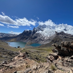
The network was accessible from all corners of the country. With it, you could go everywhere, and from any of those places to Cusco. It balanced the contrasts and difficulties of the Andean landscape, rugged and diverse, where almost all the landscapes on the planet are found together, from environments with perpetual snow, with cold moors and steppes in their vicinity, to the ravines with humid or dry forests, as well as the savannas and valleys, temperate or warm, alongside sandy areas and deserts, jungles and evergreen forests, steppes, and rocky outcrops.
During archaeological excavations in the 1980s and 90s, researchers meticulously described and characterized all the findings, including architectural, ceramic, and other material remains. These investigations indicate that, within these sites, there are material remains of Inca origin and, to a lesser extent, pre-Inca evidence. Archaeologist Kendall describes several sites around the Cusichaca River basin and refers, for example, to the Choquepata site in the upper part of Piscacucho, which is not far from the Isla Chico area. She mentions the existence of buildings and courtyards constructed on terraces, as well as the presence of ceramic materials on the surface. It is also reported that the ceramic styles present there were identified and characterized as Killke, related to Killke and Inca Cusco.
One of the earliest human settlements found along the Inca Trail to Machu Picchu is the archaeological site of Isla Chico. This site consists of 57 terraces oriented east to west, of irregular size and shape, with steep slopes of 35°-40°, adapted to the terrain and arranged in stepped sequences. Evidence of circular and rectangular enclosures is visible on their surfaces. The terraces sit directly on an alluvial geological bed that forms the plateau with a northwest-southeast projection. On the surface and in the natural cuts of the terraces, shale, pebbles, slate, schist, clay, and silt are observed in heterogeneous distributions related to the Ollantaytambo geological formation. The structures in this sector were built using semi-dressed lithic elements (slate schists, river pebbles, and granodiorites) joined without mortar. The platforms that connect with the tops of the walls have irregular lengths ranging from 1.5 to 11 meters, with heights between 0.50 and 1.70 meters. Excavations revealed the presence of early architecture associated with diagnostic pottery of the Marcavalle style, indicating an initial occupation of the site.
At other levels, ceramic fragments corresponding to the Qotakalle, Araway, and Muyuq Orqo styles (Middle Horizon) have been found, indicating a second occupation. The third occupation consists of circular architecture associated with small courtyards with a central hearth and funerary contexts attributed to a Killke occupation, and finally, a brief period of continued occupation of these structures during the Inca period. Thus, the dataset suggests a continuous occupation from the Late Formative Period (500 BC-200 AD) to the Late Horizon (1400-1533 AD) and a modern reoccupation for agricultural purposes.
These roads served not only people, but also pack animals, such as llamas, which were the usual companions of travelers. The Inca armies that traveled along them numbered in the hundreds, and sometimes thousands, of people, always accompanied by a similarly considerable number of llamas. The Inca Trail to Machu Picchu was also constantly used by the Mit’ayoq workers who had to fulfill obligations to the State outside their domestic sphere of operation, or by the curacas (local rulers) and their respective courts during their visits to the regions under their control. Likewise, the necessary movement of the Kamayuq (officials) must be considered. These officials had to carry out their specialized tasks in various parts of the empire, managing textile, goldsmithing, or pottery workshops, or overseeing hydraulic, agricultural, civil, or architectural engineering projects. All of them, in addition to the Inca and his court, who were associated with the movement of the armies, made use of this road network.
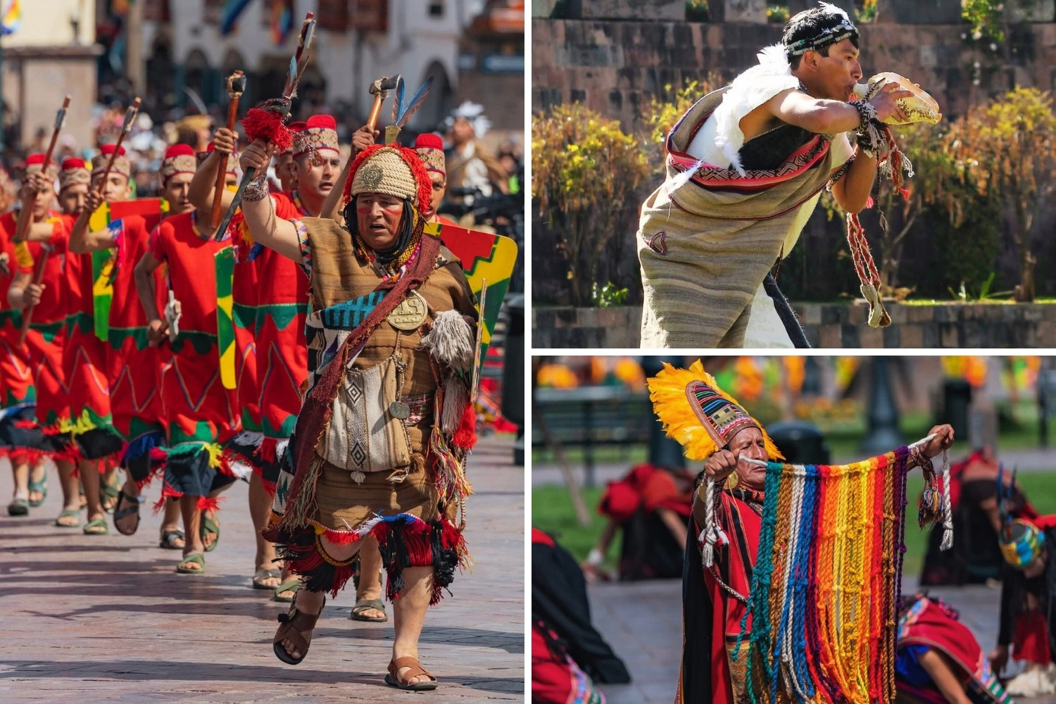
The chaskis (Inca messengers) served as couriers, ensuring the timely and efficient delivery of news required by the political apparatus for the functioning of the state. These individuals were specially trained from childhood to operate within a relay system of runners who carried messages and small objects over the course of a few days, traveling throughout the various settlements of Tawantinsuyu. Thanks to the chaskis and their mastery of the routes they covered, the Incas and other officials of Tawantinsuyu could receive information about events occurring in places far removed from Cusco, wherever they were.
Soldiers also used the Inca Trail to Machu Picchu. They traveled in groups of varying sizes and were often equipped with substantial strategic supplies, even though the empire maintained a well-organized system of storehouses or depots for provisions, clothing, and weapons along the main roads. Thus, a military caravan certainly consisted of twice, or more than twice, the number of soldiers themselves, as well as a considerable number of llamas, which, in addition to facilitating the transport of supplies, provided meat and, eventually, wool and leather. Given that a military campaign could last months or even years, this type of logistical apparatus was necessary. The road network made it possible.
The Inca Trail to Machu Picchu connected the Inca centers of power and allowed for the distribution and circulation of goods produced for those purposes. It also helped to establish new production centers or spurred the development of low-productivity areas by enabling irrigation systems or agricultural terraces near the road, even in the absence of population centers, thereby fostering settlement in uninhabited places suitable for certain forms of production or resource exploitation.
The Inca Trail to Machu Picchu, like other roads, was built to facilitate communication with Inca administrative centers, which suggests an original administrative function. Similarly, several roads were clearly planned and constructed with explicitly economic purposes, especially linked to raw material extraction sites, such as mines, or to places of agricultural and hydraulic importance, such as the lagoons that supplied irrigation water to certain valleys or basins.
Likewise, the Inca Trail to Machu Picchu served to transport minerals, timber, feathers, textiles such as wool, cotton, and other fibers, food, and goods destined for religious worship. These goods could be transported to the sacred city of Machu Picchu, but they frequently also served the complementary mechanisms that characterize the Andean economy. Thus, the transverse roads, which facilitated the exchange of products from different ecological zones, constituted a vital integrating factor for the communities that benefited from these exchanges, and for the State, which could thereby efficiently implement its redistributive programs.
While taxation was primarily geared toward exploiting the labor of the communities incorporated into the Inca Empire, the transport of goods was an important part of the system and, in a way, constituted the revenue that the State used as a basis for maintaining its power through redistribution. This is how the labor of the Mitmaqkuna (colonists) of the Inca Sacred Valley resulted in substantial loads of maize transported to Machu Picchu by extensive llama caravans, and the same occurred with shipments of coca leaves, which also had storage centers, such as those in Vilcabamba and Paucartambo, linked to the eastern “mountains” where they were produced.
Incidentally, the road network was not limited to the economic or military services on which its existence was undoubtedly based. There are also cultic or religious reasons to which we must associate the construction of the roads. Many of the roads originated from the existence of sacred sites or sanctuaries, such as Machu Picchu and Wiñaywayna. Some had strictly this function, such as connecting the inhabitants of a region with its highest peak or the lagoon, where the principal Apu or pacarina was located, to which worship had to be offered at specific times of the year. It is likely that many of the Apus and pacarinas were served by common, domestic roads, but some much more important ones, such as the road that led to the sacred residence of Machu Picchu, were highly controlled and restricted only to the Inca elite.
The design of the Inca Trail to Machu Picchu, as well as the network of Inca roads, is the largest contiguous archaeological site in South America. Since the Incas lacked wheeled transportation systems, the dimensions and construction features of the roads were adapted to the geography and the movement of pedestrians and llamas. Therefore, their dimensions and construction characteristics fully responded to these needs for the circulation of people and goods.
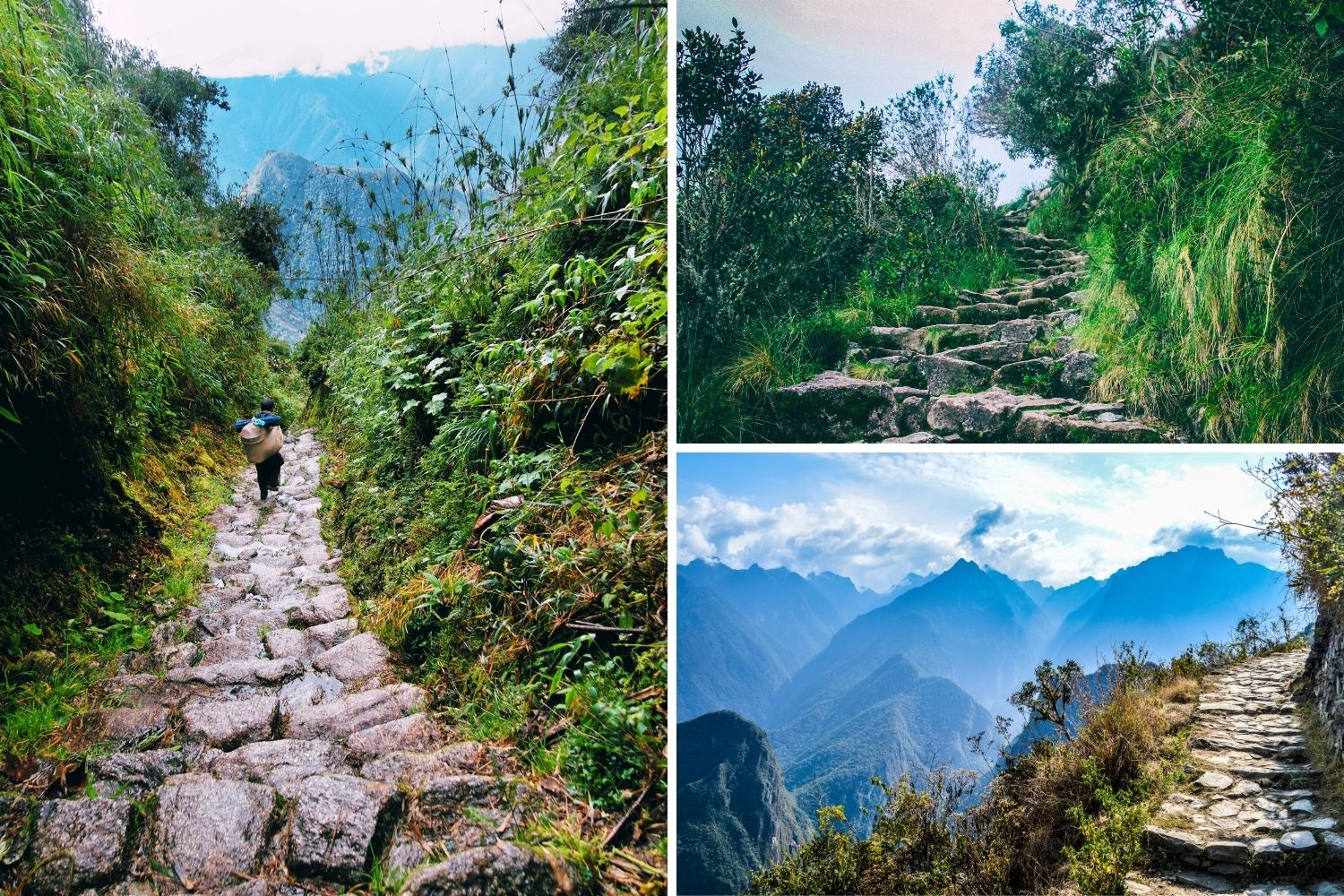
The technology used in the construction of the roads was carried out by specialized personnel who adopted techniques appropriate to the diverse terrain of the Andean landscape. Construction varied widely from the use of formalized features on main roads (retaining walls, paving, steps, elevated causeways, drainage systems, bridges) to simple paths. In mountainous areas, the road was planned to avoid slopes greater than 50º, but hillsides were unavoidable. The mountain road from Cusco to Machu Picchu is a succession of ascending and descending sections. The mountain routes incorporate gentle curves and detours to accommodate the steep slopes, mountain passes, rocky outcrops, and other obstacles. Roads crossing agricultural land had lateral walls. According to chroniclers, this was intended to protect crops from the passage of travelers and pack animals. The width of the road could vary between 3 and 10 meters.
The construction of roads in hydrated soils required several techniques: drainage channels, paving, and raised causeways. Paved sections are visible in Cusco, on the trail to Machu Picchu. The causeways, raised over bedrock, were filled with earth and often faced with stone walls. The Incas combined various construction techniques; for example, they used steps with retaining walls and excavations into the hillside, or zigzag paths. Staircases have the advantage of allowing a straight route on very steep terrain. In general, the steps are built from field stones or with minimal hewn stone, as seen in sections of the ascent along the Inca Trail to Machu Picchu, where a variety of Inca-style staircases can be observed.
The staircases required continuous maintenance by the Mitayos (forced laborers) in charge, and many segments are still in use. On main roads or at important sites, steps carved into the bedrock of the slope may be found. This type of staircase required the same kind of technology and labor as that used in the construction of fine stone masonry walls. The most common examples are roads on hillsides when the slopes run parallel to the direction of the route. If the slope was less than 15º, no formal additions were required. The general trend for roads wider than 2 meters was to incorporate lateral retaining walls as a means of reducing the slope, creating a horizontal plane for passage. A variation of this technique is found on steep slopes, between 30º and 70º inclines, where higher walls are used. A remarkable engineering achievement can be seen in a stepped segment of the Inca Road that runs through the rocky canyon of the middle Cañete Valley, with a slope greater than 50º.
The fast-flowing, narrow rivers of the Andes required various means of crossing them: bridge construction, raft crossings, or other methods. Small streams could be easily forded, except during the rainy season. For these reasons, some traffic was seasonal. Across a narrow river, long beams were laid and covered with planks and crossbeams. The Huatanay River in Cusco had a bridge constructed of large flagstones 3 to 4 meters long, many of which were still in place until the river was channeled. Some of the larger rivers are calm enough to be crossed by rafts.
Wide, deep river valleys were spanned by well-constructed suspension bridges. These were suspended from four masonry piers or towers, two on each side of the river. Each bridge required five cables, about 40 centimeters in diameter, made of twisted and braided flexible branches. The cables were wound around the timbers of the supporting towers, as taut as possible, and secured firmly. Three of the cables formed the bridge’s floor, and the other two formed the railings. For the floor, crossbeams were attached to the smaller cables and covered with smaller sticks and straw.
Within the area that is now the Historic Sanctuary of Machu Picchu, and with the aforementioned characteristics of the encomienda system, the town of “Piccho,” along with Amaybamba, was part of the encomienda of Hernando Pizarro first and later of Diego Arias Maldonado (1539-1582). The indigenous population, with absolute control over their lands and resources, paid tribute to the encomendero with baskets of coca leaves, small baskets of chili peppers, large baskets of fruit, carrying ropes, eggs, fish, and other goods. In 1561, Titu Cusi Yupanqui was crowned Inca and promoted an important capitulation with the Spanish, which included the expansion of the boundaries of the Inca government of Vilcabamba, encompassing the left bank of the Apurímac River and the right bank of the Vilcanota River. He also requested authorization to establish settlements in the Amaybamba and Piccho valleys, which were under the encomienda system of Captain Diego Arias Maldonado.
Meanwhile, the Augustinian order arrived in the area and, based on the lands that Don Felipe Topa Yupanqui, a descendant of the Great Topa Inca Yupanqui, had located in Piri in 1552 in the town of Tambo or Ollantaytambo, whose boundaries extended to the Piccho ravine, the land grant was formally awarded in 1568 to the Convent of San Agustín.
The other lands were named Turuntuy, Pampahugua, Pisca, Chuquisuso, Nacay, Macay, Tiobamba, and Guayllanga; all of them belonged to the Inca Yupanqui. The list of lands continued in the same vein, including Pumachaca and Mayu Uray, which also belonged to the Inca Yupanqui. Based on these lands, the large religious estate of the Convent of San Agustín was established, which at that time comprised the lands of Mascabamba, Huatabamba, Phiri, Tanqaq, and Chillca.
To consolidate the conquest of Vilcabamba, Don Francisco de Toledo commissioned and appointed Don Martín Hurtado de Arbieto as governor of the area and ordered the recruitment and transfer of 52 indigenous people from the parishes of the city of Cusco, along with the necessary provisions, to found the town of San Francisco de Victoria de Vilcabamba on October 4, 1572. The relocated population was obligated to serve the Spanish conquerors in Vilcabamba, just as the Cañari people did in Cusco. As a strategy, the “native Indians of Vilcabamba” separated themselves and settled in a place called “VaynaPiccho” (Huaynapiccho), at a distance of ten leagues, leading to suspicions that they intended to “praise idols in their rites and ceremonies as in the time of the Incas.”
In a 1588 memorial, several citizens of the area, including Miguel Yupa, Alonso Guaipa Condor, Juan de Malli, Francisco Coro, Cristóbal Pariguna, Bernabe Gualpa Tito, Martin Parinango, Francisco Taquichin, Pedro Paco, Juan Palpa, Juan Yauruchaco, Francisco Cicha, Francisco Coro, and Juan Yaros, stated that by order of Viceroy Conde del Villar, the Yanacona Indians transferred from the parishes of Cusco to Vilcabamba were again evicted and forced to move to a post called Vayna Piccho (Huaynapiccho) to watch over the conquered Indians, for which purpose they were assigned lands in the surrounding area.
In 1635, Don Juan Concha, Juan Tomas Concha, Juan Quispe, their sons, and the other descendants of the 52 indigenous people relocated from Cusco, secured their real and physical possession of the assigned lands, duly surveyed and marked with boundary stones, in: Vayanaycasa, Rucmabamba, Pitupukio, and Cedrobamba, whose boundaries were: “from Guaynapicho to the hill called Mallaucasa and from there to Guaironcasa and on the other side to Palcay, where a river called Uticmayo flows, which meets the Vilcamayo River, which flows all the way down, and on the other side it borders the lands of Don Baltazar Yepes, and at each boundary stone there are crosses placed since ancient times.”
In 1644, Don Juan Tomas Concha, Principal and Commander of the Yanacona Indians of the city of Vilcabamba, Peru, in the name of the indigenous population of Vilcabamba, his ancestors, and grandparents who were transferred from the parishes of the city of Cusco to said province, points out that since the time of the Incas and by distribution made to their ancestors by Viceroy Don Francisco de Toledo, they preserved the possession of the lands called Guaynapicho, Mallaocasa, Guayrorcasa and Salqantay, which were protected by the corregidores of said province and by royal provisions of the government, with which they sustained themselves and paid their tribute rates.
Indeed, according to the Compilation of the Laws of the Indies, regarding the distribution of indigenous lands, these could not be sold to Spaniards or other people, but belonged to the common indigenous person, passing from parents to children, from generation to generation, and in their absence, to their community or ayllu. Thus, these lands remained under the control and possession of indigenous people, inherited from parents to children as stipulated in the land titles, throughout the colonial period, including the beginnings of the Republic, until 1849, already in the midst of the republican period, when Don Juan Uscamaita Valentín and his wife Doña Francisca Cullo, residents of the town of Limatambo in the province of Anta, as legitimate successors of their deceased father Don Manuel Valentín Uscamaita, declared themselves to be possessors of the lands named “Suriray”, “Chillcapampa”, “Ahobamba”, “Patallaqta”, “Qquente”, the old town of Palcay, “Huairuro Ccasa mayor”, “Huairuro Ccasa menor”, “Huaynapicho”, “Machupiccho”, “Ynteguatana”, “Machopilone”, “Huaynapillone”, “Atunpilloni”, “Uchuypilloni”, “HuiñayPoccoy”, “UnoyneHuayracpata”, “Huayracmachay”, “Salqantay,” “Umantay,” and others located on the border of the valley and town of Mesacancha, which were granted as a donation to their wedding sponsor, Don Mariano Santos, in recognition of the favors and services they have deserved and received, given that they have had no children during their long marriage and are in a state of decrepitude.
Part of these lands were sold in 1860 to Don Jacinto Alegría, who in turn sold them to Don Santiago Angulo and his wife, Doña Rufina Guillen. This property, known as Yntihuatana, bordered the Silque and Kusichaka haciendas and, to the north, Huaccoto, Mediocucho-Wayllabamba, Huchuyhuayruro, Salqantay, Piccho, Hatonpiccho, Huchuypiccho, Champi Ccasa, Q’ente, and others, along the Yntihuatana River, for 450 pesos cash. Two years later, Don Santiago Angulo and his wife transferred these lands again, at the same price, to Colonel Don Ramón Nadal, owner of the Silque Hacienda. Then, in 1896, the descendants of Don Ramón Nadal celebrated a document of division and partition of property, of which the Intiwatana estate and others went to Alejandro Nadal, who in 1907 transferred his share to his brother Eduardo Nadal, with an extension of 2,000 hectares for 2,800 soles, whose boundaries were to the north, the Urubamba River, to the east the lands of Machu Picchu or Chuchubamba, to the west the Aguabamba or Ahobamba River and to the south the Palcay ravine.
Upon the transition from the Viceroyalty to the Republic of Peru, the laws regarding the legal status of “pre-Hispanic ruins and treasures” and the land tenure system for Indigenous peoples did not differ significantly. For the first years and even decades of the Republic, the laws and institutions of colonial origin continued to be applied. In other words, the first laws of the Republic did not alter the status quo and were merely declarative, reiterative, or offered little innovation regarding the previous legal framework. This was clearly the case, for example, with archaeological sites whose ownership was implicitly and explicitly assumed by the State.
At the dawn of the Republic, one of the first actions taken by the Liberator Simón Bolívar in Cusco was the expropriation of ecclesiastical property in favor of hospices and schools. From this perspective, the Silque estate of the Bethlehemite Brothers was awarded to the College of Sciences of the city of Cusco by Decree of September 9, 1825. Subsequently, the Supreme Resolution of August 3, 1826, ordered the granting of possession of said Silque estate and the execution of the corresponding “Deed of Adjudication,” which was finally granted on May 28, 1832, in favor of the College of Sciences, which was later assigned to Marshal Agustín Gamarra.
Subsequently, on November 26, 1847, Andrés Gamarra, son of Agustín Gamarra, Lieutenant Colonel of the Army and Aide-de-Camp to the Supreme Government, having incurred excessive debts with Colonel Ramón Nadal, was forced to sell the Silque estate at public auction to the aforementioned officer, Ramón Nadal, along with all its livestock, including cattle, horses, mules, donkeys, high-altitude grasslands, pastures, and other adjacent assets. The sale was executed for 42,000 pesos, paid through legal proceedings. Years later, on August 3, 1896, upon the death of Ramón Nadal’s son, Adeodato Nadal, the Nadal family descendants executed an extrajudicial deed of division and partition of the property. Thus, the Silque estate was divided into three properties.
Beginning in 1904, Mariano Ignacio Ferro began acquiring various tracts of land from the descendants of the Nadal family, particularly in the Q’ente area. The Ferro family thus managed to register their alleged ownership of the Silque estate on page 60 of volume 1 of the Cusco Property Registry. Subsequently, the heirs of Lourdes Ferro de Abril subdivided the estate into four lots, including the Santa Rita de Q’ente and Q’ente properties, and registered the division in entry 9 of the aforementioned volume.
The Q’ente property, comprising 22,000 hectares and designated as lot 4, was awarded to Emilio Abril Vizcarra. Then, by Public Deed dated September 12, 1944, Emilio Abrill Vizcarra sold the 22,000 hectares to Julio Zavaleta Flores, establishing in the fifth clause of the contract a reservation of sale that excluded from the sale the compensation payments owed to the government for the expropriation of the Inca citadels of Machu Picchu, Wayna Picchu, Wiñaywayna, Sayaqmarka, and Phuyupatamarka. These compensation payments were later effectively made through expropriations carried out by the Regional Directorate of Agrarian Reform, even though some of the land names changed, such as Inkarmana to Sayaqmarka, Yuncamallaucasa to Phuyupatamarka, and Rucrepata to Wiñaywayna. However, the names Machu Picchu and Wayna Picchu are still used today.
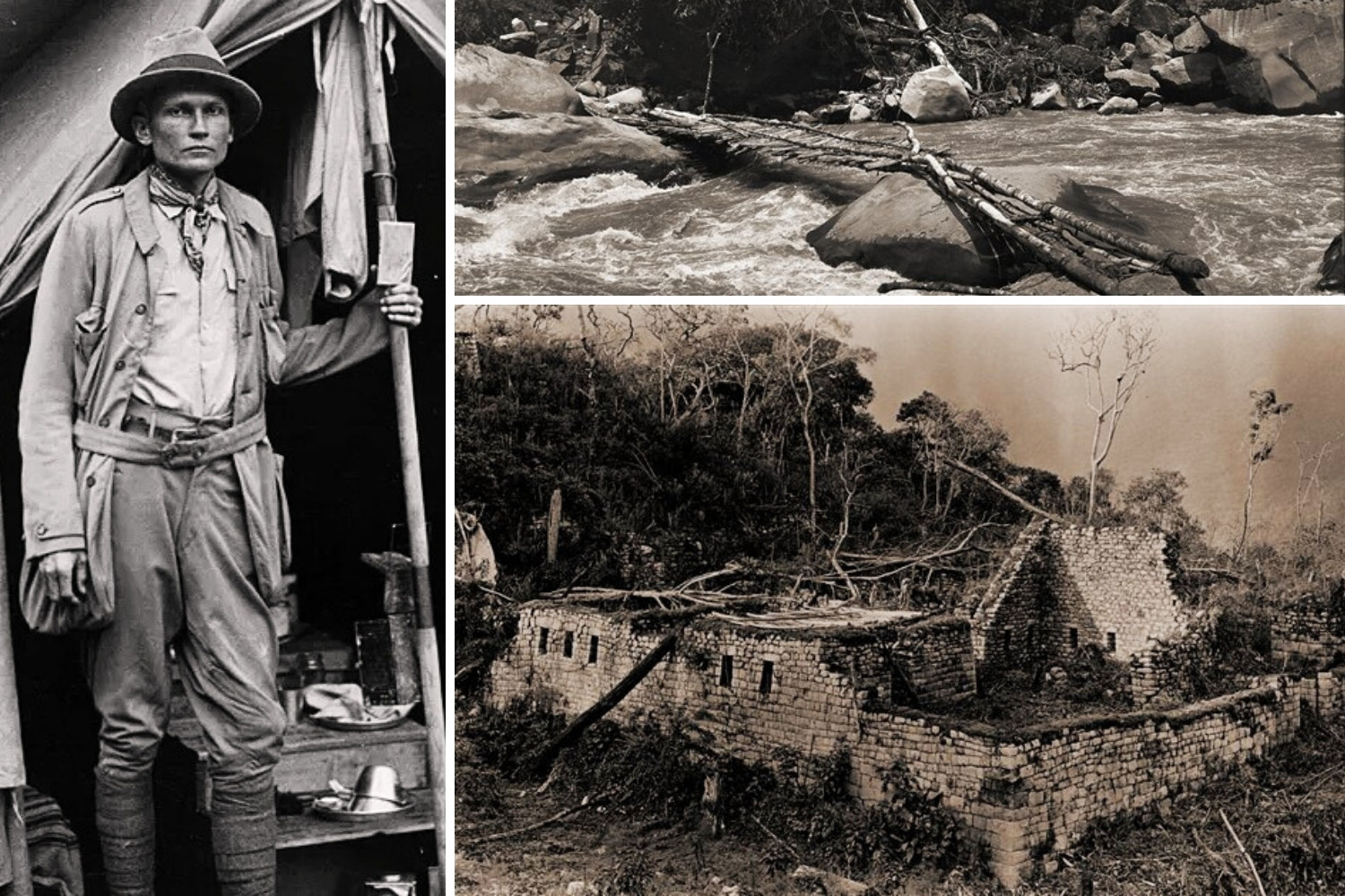
The Inca Trail to Machu Picchu, scientifically known as the Qhapaq Ñan road network, was not “discovered” in a single, spectacular moment, as was the citadel in 1911. Its rediscovery and enhancement were a gradual and complex process throughout the 20th century, intrinsically linked to the exploration and study of Machu Picchu and its surroundings. The local Andean communities of the region, such as the inhabitants of Q’ente, Wayllabamba, and others, had always known and used segments of these ancestral roads. However, for the academic and Western world, its significance became evident after the expeditions of Hiram Bingham. Upon arriving at Machu Picchu in 1911, Bingham documented and explored several sections of the Inca Trail connecting the site to other Inca centers, such as the path to Intipunku (the Sun Gate) and Wiñay Wayna, although at the time it was not conceived as a single, monumental route.
The understanding of the Inca Trail as an integrated system and its transformation into the iconic trekking route it is today was the result of decades of archaeological work and site clearing beginning in the second half of the 20th century. Following the declaration of Machu Picchu as a Historical Sanctuary in 1981, the Peruvian government, through the National Institute of Culture, initiated systematic projects for the research and enhancement of the area’s archaeological heritage. It was in this context, particularly during the 1970s and 1980s, that Peruvian and international teams (with significant participation from archaeologists such as Fernando Astete and others) cleared, consolidated, and scientifically studied the various sections of the trail, connecting the segments and understanding their function within the Inca road system (Qhapaq Ñan) and their specific role as a pilgrimage route to the sanctuary of Machu Picchu.
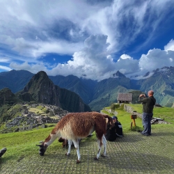
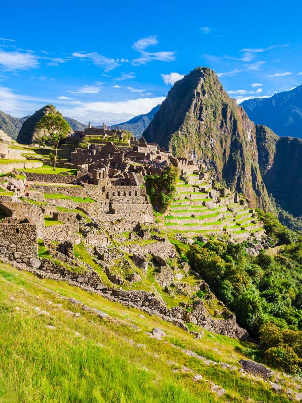
Therefore, a specific date of “discovery” cannot be attributed. The most significant milestone was its controlled opening to tourism in the early 1980s, marking the establishment of the classic 4-day/3-night route as it is known today. This process culminated in international recognition of its exceptional value, with the Inca Trail being a fundamental component for the declaration of Machu Picchu as a UNESCO World Heritage Site in 1983, under the name “Historic Sanctuary of Machu Picchu.” Its historical relevance lies in the fact that it is an exceptional and tangible example of the Qhapaq Ñan, the sophisticated road system that integrated the Tahuantinsuyo, and its conservation is a priority not because it is a recent “discovery”, but because it is a first-rate engineering and cultural landscape monument.
Explore the Manu Amazon Rainforest & Inca Trail hike to Machu Picchu, you will enjoy the best adventures in Peru, exploring amazing inca trail routes and the best amazon wildlife with our local tour guides, in small groups.

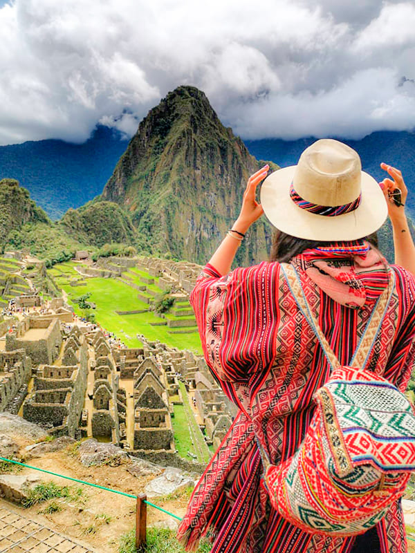
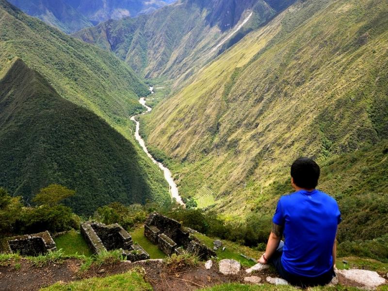
One of our most popular trips in Peru combines the cultural heritage of the Sacred Valley and the challenge of doing one of the most popular hiking trails in the world. The four-day trek on the Inca Trail will reward you with a stunning combination of the area's ruins, mountainous landscapes, and cloud forests.

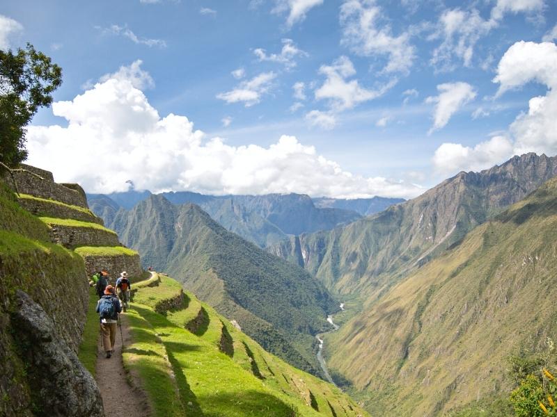
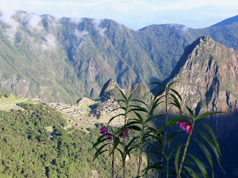
The classic Inca Trail hike to Machu Picchu is one of the world's greatest hikes. Along the 45 km you will explore unique andean valleys, lush mountain forest.An exquisite architecture of the Inca sanctuaries, which will dazzle you for its fineness and location within the Andes.